Floating the US-Mexican Border: A Packraft Trip Down the Rio Grande
Every river forms its own world. Every waterway has a different character—from the gentle creek near where I grew up to the wild and scenic rivers of the American West. As anyone who loves waterways knows: Rivers can transport us, both physically and mentally, to new places.
The Lower Canyons of the Rio Grande are home to some of the most remote waters in the lower 48. Fifteen hundred foot canyon walls, weather-stained by millennia, create twilight far before sunset. Between the canyons, the Chihuahuan Desert wraps between weathered buttes and tumbled outcroppings. The river, dusky with sediment, curls through it all.
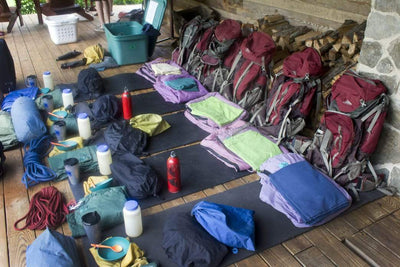
My friends and I put on the Rio Grande at Heath Canyon in January 2017. Over the course of a morning, gear exploded out of the minivan before slowly finding its way into dry bags and onto packrafts. Everyone packed slowly, eyeing one another’s gear choices, asking unanswerable questions.
“Do I really need a rain jacket?” “I don’t need this many batteries for my camera,” I said. I did not bring enough batteries. “How many fleeces do I really need?” said Robby, who needed to borrow layers throughout the trip.
We wanted a wilderness experience, to be surrounded by the desert and reliant on the river. Within a few hours, we found what we were looking for. The desert sun poured down, and the canyon walls rose around us almost immediately.

The plan was to run 84-miles of river over the course of eleven days. It can be done far faster, but we weren’t looking to hurry. We floated for long stretches without paddling, surrounded by the quiet enormity of a desert river. We took rest days and explored dry side canyons. We spent long hours around campfires catching up and talking about the future. We took our sweet time, much like the river itself.
The Rio Grande, through the Lower Canyons, is not a fast river. There are, on average, only one or two rapids per day, though small riffles form at every riverbend. We didn’t bring any research on the rapids, preferring to blindly read and run. Thundering water reverberated off the canyon walls, warning us about each rapid long before we arrived. We would run them one at a time, paddles thrashing, our packrafts bucking through rocky chutes. While most canoe the Lower Canyons (or raft at higher water), we were continually glad to have the more maneuverable packrafts. At 600 cfs (cubic feet per second), they allowed us to run rapids that we would have needed to portage with any other boat.
Between the rapids, the river forms gently flowing flatwater lined almost entirely by river cane. This invasive river cane (Arundo donax) is a recent addition to the area and at its worst, siphons off up to 30% of the Rio Grande’s flow and forms an impenetrable barrier along both banks, often reaching 10 feet into the river. Once in place, it locks sediment into the banks and gradually straightens and constricts the river channel. For boaters, the river cane is changing the landscape along the river. Several evenings, we found ourselves forced to stay on the river past sunset before we could find an opening in the cane to make camp. Texan authorities are beginning to discuss ways to control the cane, but until they find a large scale solution, don’t plan to be picky on which campsites you choose.

Deep in the canyons, we’d form small flotillas or drift along separately, sinking into the reverie of a river trip. But we couldn’t leave the outside world behind. One side is Mexico, the other is the United States. The border is an invisible presence, without fences and signs. The deepest channel of the Rio Grande marks the border along the southern edge of Texas (forming almost two-thirds of the total US-Mexican border) as it flows through urban jungles and remote desert canyons.
On paper, boaters are not supposed to cross to the opposite side except in emergency situations. But during our 11 days on the river, we each made countless unauthorized crossings, from lunch breaks to campsites. While the cane often gave us no choice on where we’d sleep, the border, like many things in the backcountry, came to feel arbitrary. On the river, facing downstream, left was the US, right was Mexico. But if the river stopped flowing, we’d have had no idea which country was which.

When we told our friends and families about our plan to float along the border, their first questions were almost always, “is it safe?” These worries are legitimate. Drug smuggling occurs along the entire border, and the Lower Canyons are no different. But all of the locals we spoke to felt safe. Marcos, a retired park ranger, lives only a few miles from the border and has never used his house keys. Keith, a boatman who has floated the Lower Canyons 57 times, said his closest calls were not drug smugglers but an infected cut and an aggressive mountain lion. On our trip, we saw only three people in 11 days, all on the last day, who ended up inviting us to their fishing camp for a catfish fry.
The most dangerous part of the Lower Canyons is not the border, but the isolation. To float the Lower Canyons is to be utterly alone. Visitors to this area must be competent and self-sufficient. My friends and I have years worth of combined backcountry experience, and are all certified in wilderness medicine. If something had gone wrong on our trip, there would have been very few opportunities for rescue.

It’s impossible to talk about the Lower Canyons of the Rio Grande without mentioning the proposed border wall. As surreal as it may seem, the American government has already conducted a bidding process, and roughly 20 companies will soon begin building prototypes in San Diego. This hypothetical wall could not be built in the river, nor between the river and the canyon walls. Instead, it would have to be built in the United States, up on the mesa, between all but a few Americans and the awe inspiring Lower Canyons, making recreational access difficult if not impossible.
There are many reasons to oppose the wall, ranging from humanitarian and ethical concerns to environmental conservation. A wall would require absurdly massive infrastructure development in such a fragile area, necessitating work camps and new access roads. In building such infrastructure, a unique desert ecosystem would be fragmented, jeopardizing hundreds of endangered and threatened animals and plants. Multiple locals informed us that, “There are already walls along the border, and they’re 1,500 feet tall” and “We don’t need a wall, we need more bridges”.

Day after day, my friends and I floated through the desolate desert, seemingly empty but bursting with life. From the water, we looked up at the wilderness surrounding us, our boats gently turning in the breeze, any ideas of the wall distant and incomprehensible. Somewhere beneath us, in the muddy water, lay the border, impossible to ignore and impossible to see. Something so important feels like it should be visible. But what should it look like? A 30 foot concrete wall? A fence with “keep out” signs and razor wire? Or maybe a river, flooding and receding through the seasons, overrunning its banks and changing its course, is the best marker for the border, and ought to teach us a lesson. The border isn’t a line on a map. The border is a region and a state of mind. And the border is worth visiting, if just for a short time.
On day 9, we decided to do a night float. We relaxed all day and put on the river in the late afternoon. We floated for a few hours before making a leisurely dinner on a warm boulder in the sun. A herd of desert bighorn precariously picked their way along the opposite canyon wall. The world sank into twilight, then into night. Soon after, the moon came up. We climbed into our boats and pushed off into the black.
We turned off our headlamps. Thick clouds passed over the moon, throwing shadows and deeper darkness. We navigated by sound, the cool breeze rustling the river cane, the water lapping against our packrafts. I knew my friends were all within a few hundred feet, but I still felt utterly alone. No one spoke. Animals scurried through the underbrush along the river. The boat lurched and accelerated down a small rapid I couldn’t see. I fought off the urge to turn on my headlamp. Waves splashed my hands. The canyon walls were black against the stars.
I floated between the United States and Mexico. Disoriented by the darkness, I finally forgot about the border and about the greater world in general. There was only the river, curling through the desert.
If you’re interested in learning more about our trip, the Lower Canyons, and the border wall, feel free to check out my website, where I’m working on a documentary.
Details for the trip, because they can be hard to find:
- Seasonality: October to May (the highest water is in the fall). Don’t do it in the summer.
- Miles: 84
- Days necessary: 7 or longer
- Whitewater: III+ to IV depending on flow
- Water: Drink out of the Rio Grande and fill up at seasonal springs along the river.
- River Flow: Check the Rio Grande Village USGS water gauge. Over 200 cfs is easily runnable, over 1000 is high water and might be safer in a larger raft.
- Put in: Heath Canyon (private land owned by Heath Canyon Ranch). In 2017, fees were ~$10 for access, ~$5 a day for parking.
- Take out: Dryden Crossing (private land owned by Harrison Ranch - contact Jon Tom Lowrance). In 2017, fees were $30 per vehicle and $10 per person.
- Shuttle: 4 hours (160 miles), involving some rough dirt roads near the takeout. Various shuttles are available, all for over $300, which may be worth it, as most waive the private land access fees.
- Permitting: $12 backcountry use permit available at any visitor center in Big Bend National Park.
- Hot Springs: Can be found immediately after Hot Springs Rapid (mile 40.7) on the Mexican side.
- Pro tip: Fish for catfish using a plastic bottle with a handle, attached with strong line or cord to a big hook covered in “stinkbait”. Throw it in the river before you set off every day. It’ll get stuck in the cane constantly, but if you’re patient, you’ll catch a catfish and can have an unforgettable dinner.
List of Required Items:
- Personal Flotation (PFD’s) for each participant and one extra
- 1 extra paddle per raft, 1 extra paddle total if canoeing or kayaking
- Human waste management system
- Patch kit (if in inflatables)
- Fire pan with 2 inch minimum rim
- Trash management system


